New Orleans is not without its charms outside the French Quarter. All throughout the main part(s) of town, including the part with Tulane on the west/north side and the central business district on the east/south side, streetcars run pretty regularly to get you around. While it was reliable, safe, and comfortable transportation, it didn't appear to be quite as expedient as a bus system. The poor drivers seemed to spend a lot of time explaining to tourists that they need exact change and here's how you put the ticket into the fare-system-thingy, and so on. We saw mostly visitors on it, but locals not in a big hurry (i.e., running late or on a tight schedule) also used it in decent numbers. I'd say the tourist-local ratio was about 70-30 in the city and 40-60 in the outlying areas.
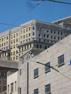
The rest of the city has a distinctly different feel than that of the French Quarter. After the Louisiana Purchase, the Catholic French/Creole/Haitian citizens of NOLA were annoyed at the now-in-charge-sorta-kinda English-Puritan WASPs showing up to rain on their already-humid parade. Canal Street, the setting of a couple of the photos below, is the western/northern border of the French Quarter, and it is the point at which the flavor changes. All the street names change, like from "Bourbon" and "Chartres" and "Royale" in the FC to "Carondelet" and "Camp" and "St. Charles", respectively.The buildings take on a distinctly more modern look and feel, though I mean "modern" in terms of "from the past 80-100 years". New Orleans doesn't know or care, it seems, what year it looks like there, as long as it's not a year before about 1998. It threw me off, I think, to see so many buildings and spaces from the past without any real allusion to the present. Of course, I was also in the more touristy areas, which may have something to do with that look and feeling


1 comment:
Hooo-weeee, chere. [fanning self]
Post a Comment